
The Fate of the Augusta County Frontier
Augusta County was a very large county when formed in 1738 and included more than 100,000 square miles of unknown land. Given its size, the land grants, and the settlement that took place on this land over fifty years, Augusta County was destined to be divided into new counties and states.
By 1740, the West Augusta District of Augusta County was designated to differentiate the eastern and western sections of Augusta County. Because of land grants and the agendas of the land grant recipients, Augusta County would soon be divided to form new counties. The natural progression for county formation would follow the thinking of the land grant holders from the Loyal Company Land Grant (to the south and west of Staunton) and the Ohio Company Land Grant (to the west and north of Staunton). The natural divide would be the Ohio River.
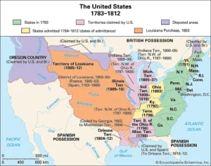
In 1770, just prior to our Revolutionary War, a very large tract of Augusta County land was designated Botetourt County. In 1772, a large portion of Botetourt County was designated as Fincastle County. In 1777, many other Virginia counties, including Kentucky County, were formed from Botetourt County and Fincastle County. Kentucky County became the State of Kentucky in 1792.
To the north and west of Staunton, the West Augusta District of Augusta County was also undergoing change. In 1753, Hampshire County was formed in part from Augusta County. In 1776, Ohio County and Monongalia County were formed from the West Augusta District of Augusta County.
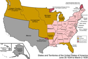
Shortly before and just after the Revolutionary War, much of the land of Augusta County was designated into smaller counties. Some of these counties remained a part of Virginia while other parcels were combined to form the states of Ohio, Kentucky, Illinois, and Indian, including parts of Tennessee, Pennsylvania and Maryland. The Northwest Territory of Augusta County provided land for the statehood of Michigan, Wisconsin, and Minnesota
A 1780’s survey of the Virginia – Pennsylvania border designated that Fort Pitt (Pittsburgh) was a part of Pennsylvania. By the end of the 18th century the boundaries of present-day Augusta County were well defined, and the 18th century wilderness frontier became the home to thousands of families that built houses, farms, businesses and developed state and county governments. While Augusta County and the Augusta County Frontier was the staging ground for western exploration and settlement including statehood for many states.
By the end of the 18th century, many, first and second generation, family members from Augusta County had moved west to land given to their family members by land grants for their serve in the French and Indian War and the Revolutionary War. There is a good chance that if you family was in America prior to 1800, you may find that your family roots can be traced to Augusta County.
Page developed by Gordon Barlow gordon@amaty.com